Day 45: Wasa Lake, BC – Radium Hot Springs, BC

Another hot day. After retrieving our bear-bagged food and packing up camp we headed north and immediately ran into a French couple touring on recumbent bikes. They started in Vancouver and are headed to Jasper as well. After a quick chat we went our separate ways, only to run into a southbound solo tourist riding the ACA route to Missoula less than an hour later. I guess touring season is in full swing up here!

We arrived in the town of Canal Flats for lunch to find that the only restaurant in town is closed for renovation. Grocery store food it is! My lunch consisted of 1) a packet of vegetables and ranch dressing, 2) a liter of lemonade, 3) half of a packet of deep fried pork that was sitting under a heat lamp, and 4) a large slice of banana cream pie. Lunch of champions.

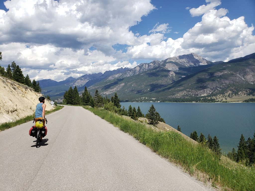
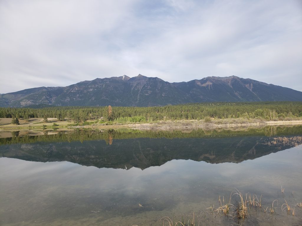
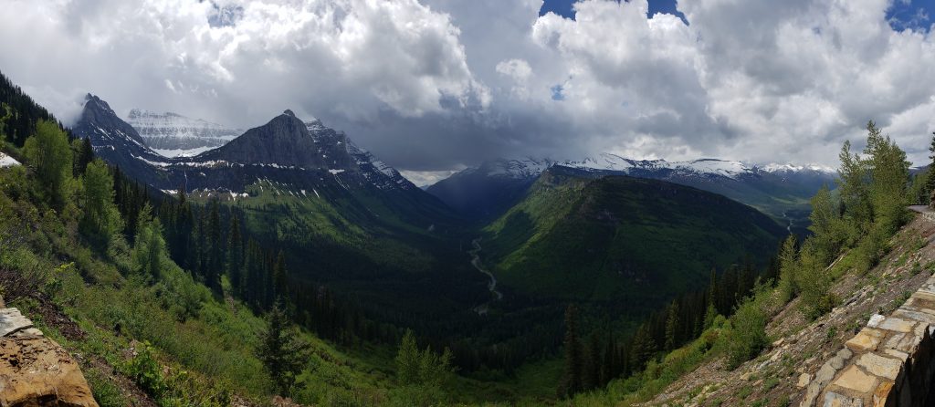
We’d been following the Kootenay River for the last day and here it took a turn up a different valley, where we’ll be tomorrow. The river we were now following was the Columbia River – tributary of the Kootenay River, tributary of the Columbia River that runs through Washington State and Oregon. It takes quite a long time to reach the Pacific but it’s pretty amazing to see how big these rivers are despite being so many hundreds (thousands?) of miles inland.

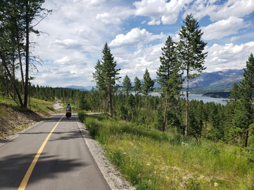
Back on the road and we continued our pattern of taking every side road possible, and one of the side roads turns out to haveĀ  a bike path along it! These bike paths are always a little bittersweet – you can get away from traffic but often timesĀ  the paths are twisty and poorly graded so there’s a lot of extra climbing and not a lot of fast downhills.

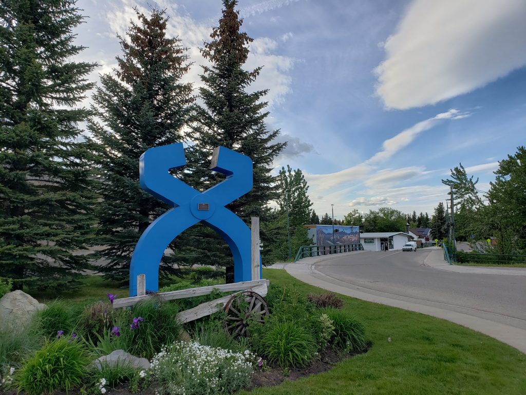
The bike path drops off into the town of Invermere which looked like a neat little ski/bike town from the map. But reality doesn’t always match expectations. The town tried to offer bike facilities (bike lanes, paths, etc) but they were not very well implemented – poorly marked and not connected. Intersections were also insufficiently labeled/poorly planned, and to top it off we ran into a number of unpleasant drivers in the few minutes we were in town. Glad we weren’t planning on staying here for the night!

Another hour of riding brought us to the town of Radium Hot Springs, BC where we found a motel for the night. Remember day 1 when we stayed in Radium Springs, NM? We’re finally at Radium Springs #2 for the trip!

The motel owner gave us free passes to go to the hot springs in town so we biked up the steep hill into Kootenay National Park where there’s a pool fed by the hot springs. The pool was a nice change of pace (although I wouldn’t consider it an attraction in its own right). After dinner we ran into our next door neighbor in the motel who had done bike tours in the past, so we swapped stories from tours before saying farewell.

Notes from Donald: “Today was pretty hot and sunny. Stopping at Dutch Creek to stick our heads in the water was really nice until I got brain freeze. The water was very cold! I’m glad that the owner of the Inn in Radium convinced us to go to the hot springs.”

Today’s mileage: 76 miles

Total: 2420 miles

Day 44: Fernie, BC – Wasa Lake, BC

Hot weather is back! After stocking up on some groceries we headed out of town, having to cut twenty miles south to get around a mountain range before heading north again. We planned the route ourselves for most of this trip but we’re now following Adventure Cycling’s “Great Parks North” route which will take us to Jasper. The route has a “gravel alternate” route for these twenty miles and we take it in hopes of getting away from traffic.

The gravel road was indeed nice and quiet and we only saw one logging truck (and only made one wrong turn taking us a mile out of the way, and only almost fell off the road once each). Before long we were dumped back on the highway and ate at an outdoor fast food place in Elko. We had come so far back south that we were only twenty miles from the US border!

Towns are small and far apart here and we stopped in each one to pick up cold drinks and get some relief from the hot sun. Soon, larger mountains appeared to the left and right as we entered the valley proper. Getting photos from the road is always a game of waiting for the power lines to move out of the way so they’re not in the shot.

We also had our first moose sighting! There are barbed wire fences on either side of the highway and it’s impressive to see such a large animal clear the fence easily. I haven’t talked about wildlife much yet! We’ve got most animals sightings checked off now – two black bears in Glacier National Park, three moose here in BC, tons of deer everywhere (including one who got very startled by us on the gravel road this morning and was incapable of figuring out that we were riding down the road, and as a result got “chased” by us for a full mile). Lots of prairie dogs (or similar) along the whole route, and even a glimpse of badger in Idaho. No grizzlies yet though (and I’m okay leaving it that way!)

More hours of hot riding and we finally arrived at Wasa Lake and grab some bar food at a small pub before heading to the campground in the nearby state park. This campground is massive – there are four roads in it, each a full half mile long. Also, showers! We pitched our tents, bear bagged our food, and escaped from the mosquitoes.

Notes from Donald: “Riding twenty miles of gravel was fun and a nice change from roads with their traffic and noise. Also, tossing shampoo between shower stalls is hilarious!”

Today’s mileage: 80 miles

Total: 2344 miles

Day 43: Pincher Creek, AB – Fernie, BC

We started out the day heading west through a rural valley back towards the mountains. But what appeared from afar to be flat turned out to be nonstop rolling hills and after twenty miles we had covered more than half of our elevation gain for the day.

The road led towards the mountains and came upon a large field of boulders. As described by roadside signs there was a rock slide here in 1903 – the deadliest in Canadian history – and the debris is still here as a reminder of that day. A man was pulled over on the side of the road with a large “Information” sign on his car and came out to talk to us about the rock slide and try and sell us a book he wrote about it.

Large mountains were close now to both the south and north. These are the mountains I came here to see – the iconic Canadian Rockies mountains with pine trees leading up steep slopes before giving way to a rocky upper mountain with distinct angled striations. I could almost be satisfied to head home now, but we’re close enough so might as well see a whole bunch more of them in Banff and Jasper.

After a good lunch of barbecue we headed towards Crowsnest pass and crossed into British Columbia. Our route is a bit circuitous around here because we took Going to the Sun Road all the way across the pass and now have to cut back west (and south!). But the riding is good.

Along the road we came across the world’s largest truck – a prototype mining dump truck that was used in the open coal mines here in the 70’s and 80’s – now relegated to a tourist attraction. While biking through Kansas I saw the world’s largest ball of twine and Donald and I witnessed the largest fishing rod (in Canada?) in Houston, British Columbia. I suppose no tour is complete without a “largest something or other” attraction – glad we got that checked off.

We arrived in the town of Fernie and found a place to stay. Fernie seems to be another cute ski/mountain bike town and many of the lodging options in town have hoses out front to wash down mountain bikes. Our motel has free laundry machines and everything is right in the world.

Notes from Donald: “New province day! And we got to see the world’s largest truck, which was big.”

Today’s mileage: 76 miles

Total: 2264 miles

Day 42: Babb, MT – Pincher Creek, AB

Finally some sun! After a number of wet days some dry weather has been a nice change of pace.

The first few miles today were on our good friend US 89. We first got on 89 four miles from its southern terminus in Flagstaff and followed sections of the highway in Arizona, Utah, Wyoming, Idaho, and finally a little bit in Montana. Fittingly, we departed the highway six miles from its northern terminus to take a different road to the border. So long, old friend.

The terrain here on the eastern side of the Rockies is no longer the domain of dense pine forests but rather high grasslands and green aspen groves. Every bit of the experience is warmer, brighter, and more vivid than the last few days (of course the weather plays a big role in this as well!) The road skirted around the mountains of the Glacier range and the stunning steep walls of Chief Mountain peeked above the hills from time to time.

Large rolling hills eventually brought us to the US-Canada border and Canadian customs went very smoothly – unlike six years ago where we were grilled about the minutia of our trip.

We left the US from within Glacier National Park and entered Canada into Waterton Lakes National Park – effectively the north side of Glacier. More hills brought us to overlooks with magnificent views of more mountains in this range, but as we headed north the mountains soon receded and turned to high prairie.

A few more hours of windy riding brought us to the town of Pincher Creek where we found a place to stay.

Notes from Donald: “New country day! Also new province! And we went through my first Canadian National Park!”

Today’s mileage: 62 miles

Total: 2188 miles

Day 41: Sprague Creek Campground, MT – Babb, MT

We spent a while in the morning waiting for all of our gear to dry after the overnight rains. In heavily wooded campgrounds this is a challenge as you need to constantly be moving gear to stay in the small patches of sunlight as they move across the campground floor.

The park road was open to cars for the first seven miles after our campground and being a national park it was heavily trafficked and had no shoulder. So we wound up pulling over a lot to let cars pass until finally arriving at the gate restricting car access.

To say there were a lot of cyclists would be an understatement. We saw at least dozen cyclists getting ready to ride the road, and many many more on the past the gate. I suppose it shouldn’t have been a surprise given that a weekend with cars prohibited on such an iconic road can come at most once a year.

We started out following the rapidly moving McDonald Creek but before long the creek was left far below as the road ascended one side of the valley. The valley sides are steep – nothing but cliffs at times – and so the road had to be built on a precarious edge with vertical cliffs towering above on one side and dropping off on the other. Needless to say the road is very narrow, has no shoulder, and lots of rock debris scattered across it. This would be hellish with cars on it but is quite pleasant with just bikes.

Not to go a day without getting wet, it started raining then hailing but the hard work of the ascent meant we didn’t need don out our rain jackets. Higher still the crowds began thinning out – some folks appeared to be turning around halfway. Surprisingly, we didn’t get passed a single time despite seeing maybe two hundred other cyclists. Maybe the more serious cyclists started earlier in the morning.

The ascent was filled with one magnificent view after another as different parts of the valleys came into view and storm clouds obscured and revealed majestic snow-covered peaks. Because of the lack of vehicles we could stop anywhere for a photo instead of the rare designated pullouts – much nicer this way.

The rain came and went and eventually turned to graupel (remember the snow-like precipitation from Bryce?) and by the time we reached the Logan Pass there was a steady snowfall. The visitor center and restrooms at the top were still closed so we only stayed a short while before beginning our descent down the other side of the pass. This side of the pass was shorter and completely empty – all the other cyclists went back down to the parking lot on the west side from which they had come. According to a ranger we were the first cyclists this season to go all the way over the pass to the other side.

The remainder of the day was comprised of seeing the sights on the road out of the eastern side of the park, eating lunch at a bizarre restaurant in St. Mary, and calling it a night in the tiny town of Babb where we were once again the first visitors in the motel for the season.

Notes from Donald: “Riding Going to the Sun Road was challenging but had lots of great views. It even snowed at the top! Hopefully that’s the last snow we see.”

Today’s mileage: 51 miles

Total: 2126 miles