Day 23: Springville, UT – Park City, UT

Another cold and cloudy day. We worked our way through the suburbs of Provo and onto a bike path that parallels highway 89 and leads up a river valley into the mountains. The path was a nice change from our typical highway riding and the mountains rise sharply on either side of the valley with towering cliffs and waterfalls appearing regularly.

All things must pass and the path soon ends and we’re back on the highway. The shoulder is thankfully very wide today as there’s much more traffic than previous days, thanks to our proximity to population centers.

The rain comes and goes and we grab a late lunch in a nice fusion restaurant in Heber City. The last couple hours are a long uphill back up to the ski town of Park City at 7,000 feet.

For the second time in three days a truck “rolls coal” at us – using a vehicle modification to intentionally emit excess smoke. Luckily these drivers are not very skilled at their practice so we’re not affected much, but the fact that people like this exist is saddening.

We arrive in Park City and get some much needed sushi. It’s off season now – between ski season and mountain bike season so we’re given a 50% “locals discount.”

Notes from Donald: “I really enjoyed riding on the bike path from outside Provo to Vivian Park. I also enjoyed the bike path off the highway into Park City. The highway, not so much.”

Today’s mileage: 54 miles

Total: 1216 miles

Day 22: Price, UT – Springville, UT

The front desk of our motel rang our room this morning to make sure we made it to breakfast. The owner and her friend were in the breakfast area and helped us make waffles while peppering us with questions about our trip. We got a recommendation for a place to pick up sandwiches for the road – Marsha’s in Helper – and bid them farewell.

Highway 6 winds through a canyon up the Price River. There’s more traffic than we’ve seen in a while but at least the shoulder is good. Not to go another day without some weather, it starts raining then hailing as we ascend towards a mountain pass. Before long I get another flat – presumably from the bad rim tape again. We make it to the pass at Soldier Summit at 7500 feet and warm up in the lone convenience store by the highway.

It starts precipitating again – in what would best be described as a “wintry mix.” We look outside in dread for a while before moving downhill into the weather. After a few cold descents over the past week we’ve got our cold weather situation down pat – the colorful stuff sacks over our handlebars do wonders to keep our hands warm.

The wind seemed to have been missing us and returned today, slowing our descent towards the Provo area. After a few more hours of intermittent rain we we arrive in the suburb of Springville – full of strip malls and more restaurants and lodging options than you could ever need – and find a place to stay.

Notes from Donald: “It’s strange coming back into a heavily populated sprawling suburban area.”

Today’s mileage: 72 miles

Total: 1162 miles

Day 21: Ferron, UT – Price, UT

The route from Ferron to Park city is 160 miles and we’re planning on covering the distance in 3 days – leaving today as the short day. On our way up the road we pass through a couple more rural towns – Castle Dale and Huntington. These towns have slightly more food options than in Ferron last night, but still only one motel each.

Last night when we walked into the motel, instead of a typical lobby and registration desk, the motel was combined with a gas station and convenience store. The two teenagers working there didn’t know how to check guests into rooms so they called the owner who was able to get us set up. She was extremely helpful but the situation made it painfully clear that not very many people stay at that motel.

This makes me wonder about the future viability of bicycle touring in areas like this. There’s been the long and steady trend of people moving from rural areas to large cities and of course the introduction of the interstate system has had lasting impacts on the number of travelers who take roads like this. After cycling past so many abandoned motels and seeing the low usage rates of the lodging options still in operation it makes one wonder if in the future it’ll even be possible to have places to eat and rest in small towns. Or maybe the urbanization trend will reverse. Only time will tell, but I’m happy to be traveling this way while I can.

Back on the road today, heavy rain storms filled the horizon to the east while snow fell on the mesas and mountains to the west. We were thankfully spared from both as we headed north.

After a quick lunch in Huntington I got another flat – this time perhaps due to my rim tape no longer being aligned. I patched the rim tape up and put in a new tube and we got back on our way.

Besides this the day was largely unremarkable. The weather was cold but not frigid, the wind was blowing, but from the side, and we arrived in the town of Price. There’s a supermarket and a Walmart here – signs that we’re getting back towards more populated areas for the first time in two and a half weeks. For the next few days we’ll be going through cities/suburbs and are looking forward to getting our fill of meals that aren’t American, Mexican, or American Chinese.

Notes from Donald: “Today was a nice short day. I’m glad we didn’t get hit by any 50 mile an hour crosswinds or rain.”

Today’s mileage: 43 miles

Total: 1090 miles

Day 20: Torrey, UT – Ferron, UT

The blue skies and fluffy clouds of yesterday had been replaced with strong winds, frigid temperatures, grey skies, and pockets of snow and rain here and there. A great day to tackle a 9,000 foot mountain pass.

Our short-term destination right now is Park City and we’ve chosen highways 72 and 10 to take us north into Central Utah. After finding our turn, the road started winding up a valley into the mountains and the rain began. Higher still, the rain turned to a light snow that increased in intensity and began piling up on our jackets. The visibility dropped and passing cars became rarer and rarer – this section was very reminiscent of the rainy and snowy days in the Canadian mountains six years ago.

After a couple hours of climbing we reached the pass at 8,975 feet. Unlike yesterday, reaching the pass was not a relaxing affair – given the weather we didn’t want to stick around too long. We quickly added layers and got to the descending, squinting to try and see the road through the heavy wind and snow. Just like two days ago, frozen hands quickly became the limiting factor as we took frequent breaks at the numerous scenic overlooks to warm our hands. The quality of these viewpoints I cannot comment on as we had maybe 200 feet of visibility. I fashioned a wind and snow shield for my hands out of a stuff sack and we proceeded downwards.

The snow turned to rain and after a long while finally began lightening up. It was now after 3 in the afternoon and we hadn’t eaten so we stopped for a quick snack break. Just like in Arizona, we have a knack for picking routes that don’t see towns very often – the route today went 70 miles between any sort of cafe, store, or gas station – we had nowhere to take refuge from the weather.

Eventually the road went under I-70 and headed out of the mountains into rural land. Coal mining seems to be the dominant industry here as evidenced by the large quantity of spilled coal on the highway shoulder. Our tailwind from the morning had left us before the mountain pass and never returned and we pushed onwards in search of a place to stay for the night.

I got a flat tire and replaced the tube just in time for the rain to start up again, this time turning to hail as we approached the town of Ferron. There’s a single motel/food option in town that closes at 7 and we are lucky to have arrived before they closed lest we’d need to push on to the next town. The dinner options consist of fried chicken tenders, fried mozzarella sticks, fried jalapeno poppers, and a hot pocket. We buy every last item available and take them back to our room to enjoy our healthy dinner.

Notes from Donald: “We encountered most forms of precipitation today – snow, rain, hail, and probably some sleet. The snow climbing to the 9,000 foot pass was beautiful but made for a very frigid downhill.”

Today’s mileage: 80 miles

Total: 1047 miles


Day 19: Escalante, UT – Torrey, UT

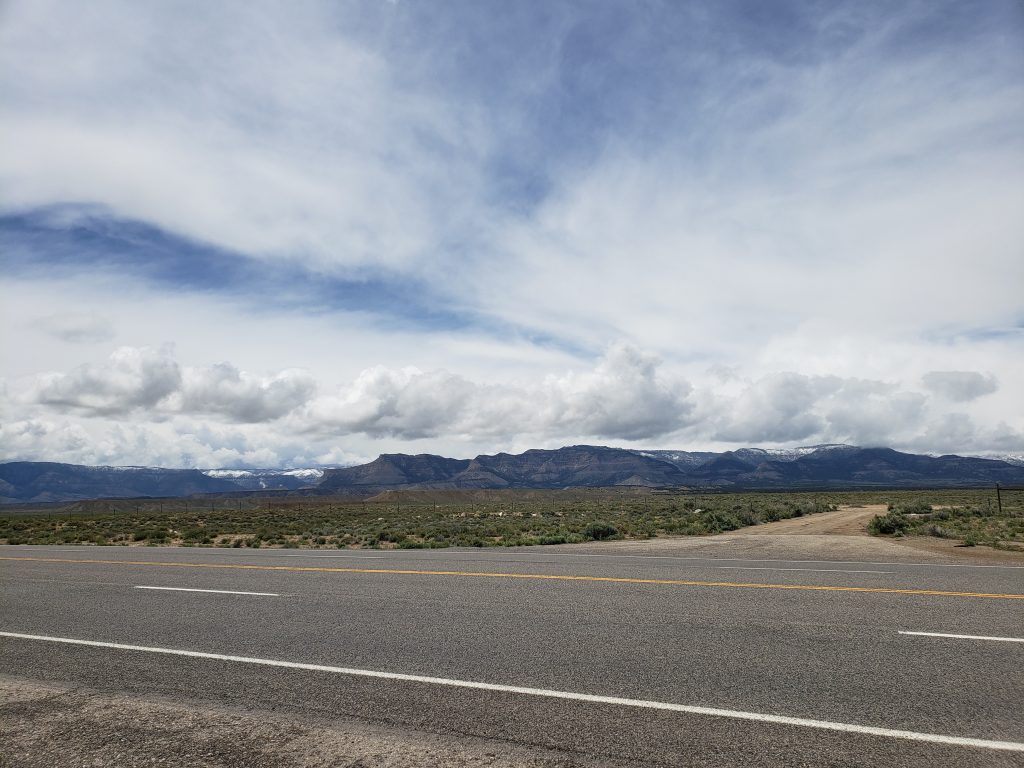
Pinned up on the wall of our motel’s lobby was a printout of the top ten best roads in the world. Highway 12 in Utah was listed as number 2 on the list, as enthusiastic highlighting made sure we knew. We had been on highway 12 for the last 60 miles and it certainly was a nice road but I wasn’t sure why it was given such high accolades.

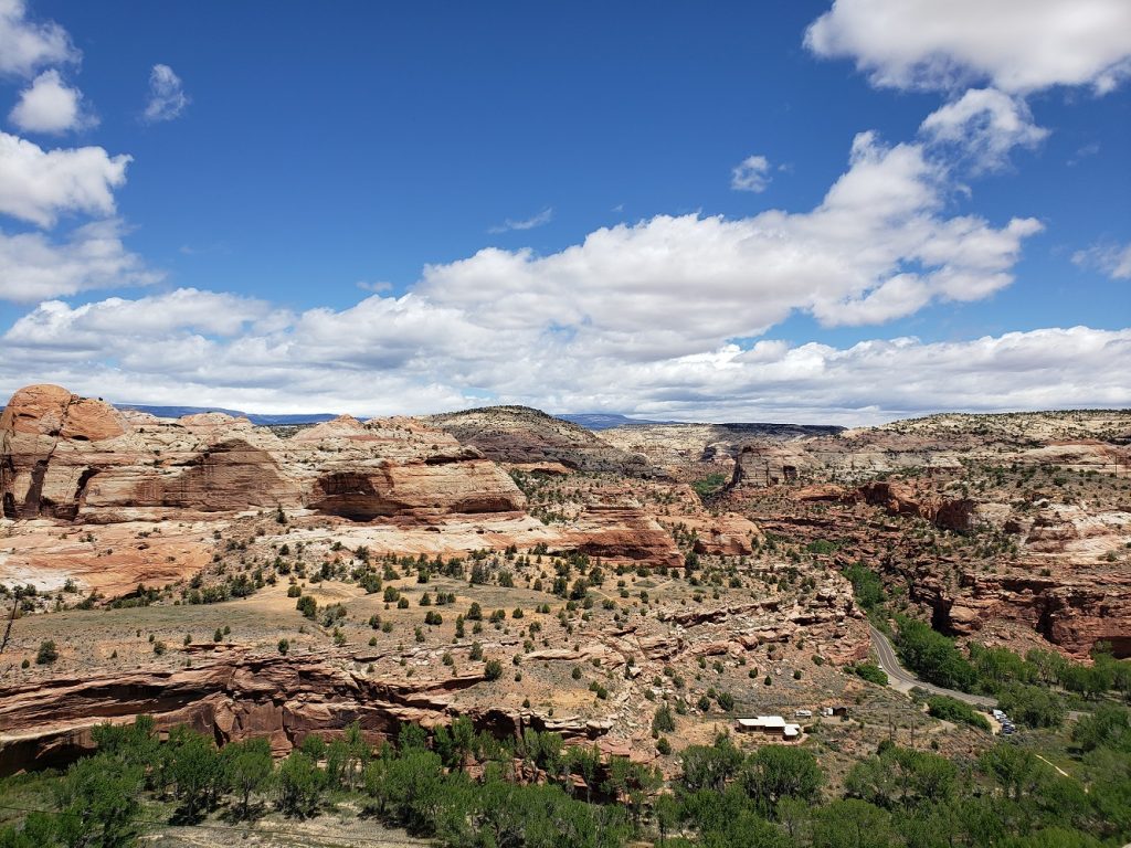
The road out of Escalante took us through rolling desert hills with cliffs lining the view to the south. Every few miles a pullout with an interpretive sign would talk about the history or geology of the region, pointing out ancient granaries of the Native Americans, or recalling tales of early Western settlers. After a long climb the road turned and revealed a dramatically different view – below us lay a landscape dominated by smooth bare rock surfaces while twisting cliffs and canyons holding the Escalante River and its tributaries carved through the scene.

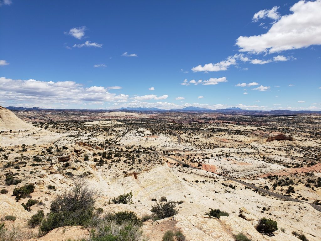
Not to be satisfied with just looking at the view from above, the road dove down into the midst of it. First, along the smooth rock hills and then down and down to the canyon floor. Down here the scene was completely different – the tall red walls towered above and vibrant trees lined the insides of the canyon along Calf Creek. The sterile silence of the landscape above was replaced with a chorus of birds inhabiting this small, lush world.

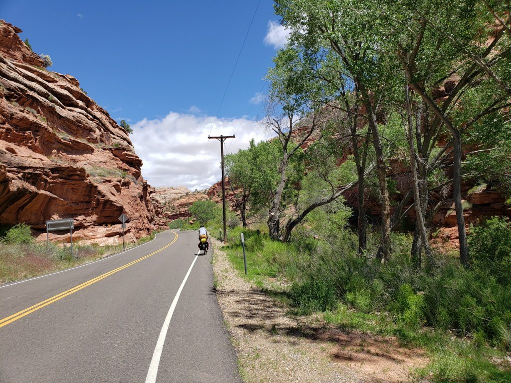
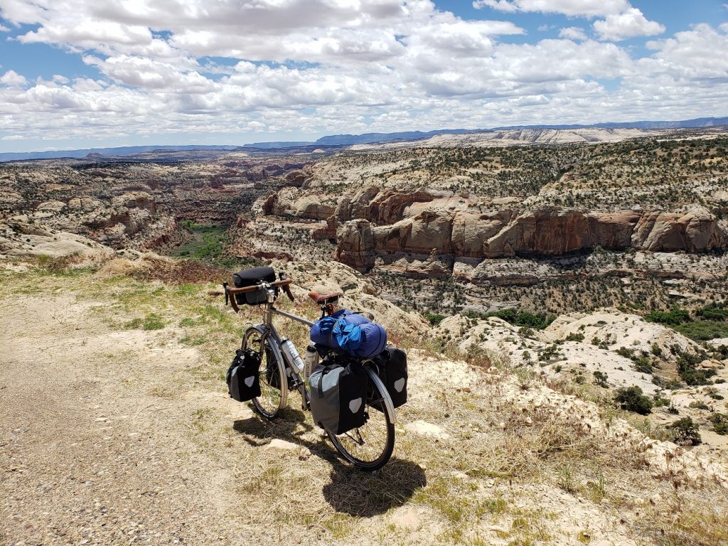
The obvious limitation of building a road through such a canyon is that it’s nearly impossible to grade it well. Flat sections were punctuated by extremely steep hills as we crawled up the canyon walls and I was once again reduced to my lowest gear. Eventually the road ascended above the canyon and onto a ridgeline heading towards the town of Boulder, UT. There was a pullout where motorists could get a photo of the canyon, but a small stretch of gravel accessible only to bicycles had a much nicer view and I fiddled here with getting my bike to stand upright against a small rock for a photo.

It was past lunchtime and the road finished its tour through the rocky wonderland and opened up into a green valley and the town of Boulder. We had covered a little under 30 miles and a little under 3000 feet of elevation gain but the day was just getting started. Between us and our destination for the evening lay a massive mountain pass at 9600 feet, with 4000 feet of elevation gain remaining to cover in the afternoon. We had our work cut out for us.

We stopped for a surprisingly good meal at the Burr Trail Grill and got back to climbing. The ascent starts right out of town as the road heads straight north into Dixie National Forest. Before long we ran into a pair of touring cyclists that we had talked to briefly in Bryce a couple days ago. They’re Polish and had started in Denver a month ago, meandered around the west visiting parks, and were on their way to Salt Lake City to finish their tour and move on to the next stage of their trip. They were very heavily loaded – making our panniers look tiny in comparison – but were in good spirits. We bid them farewell and headed upwards.

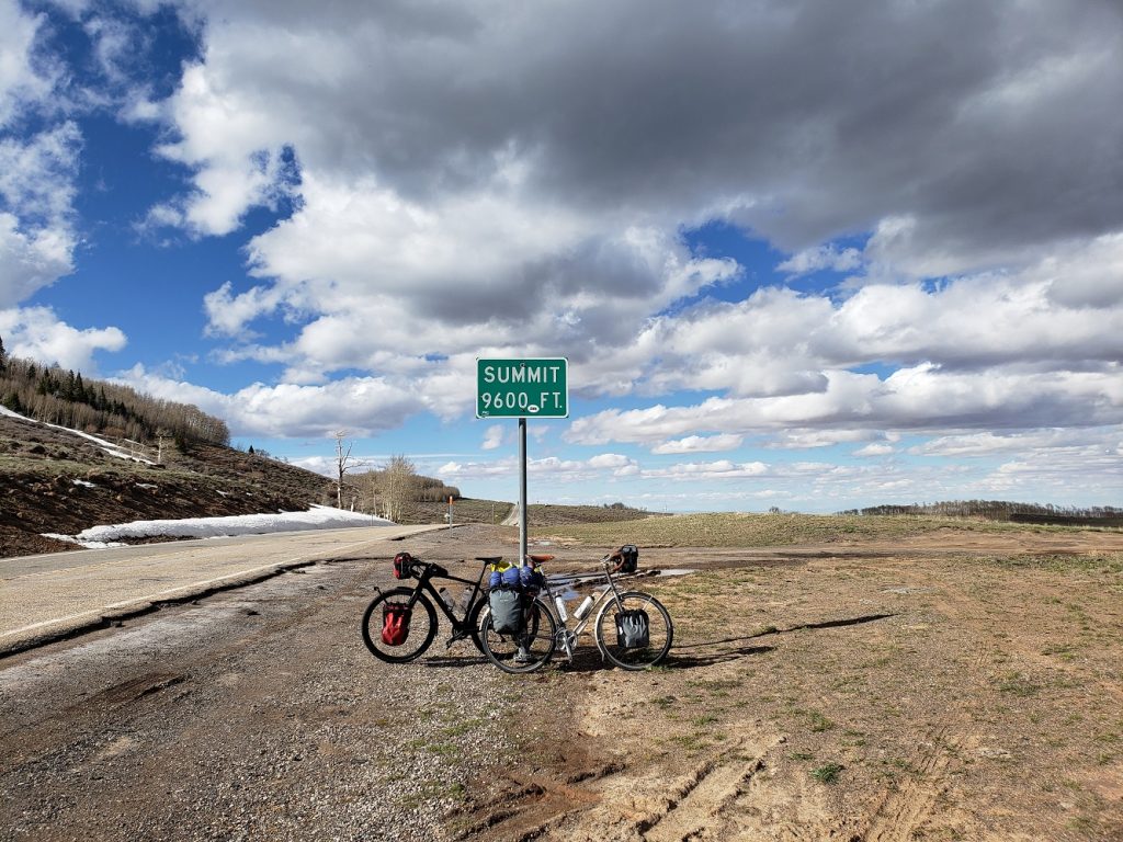
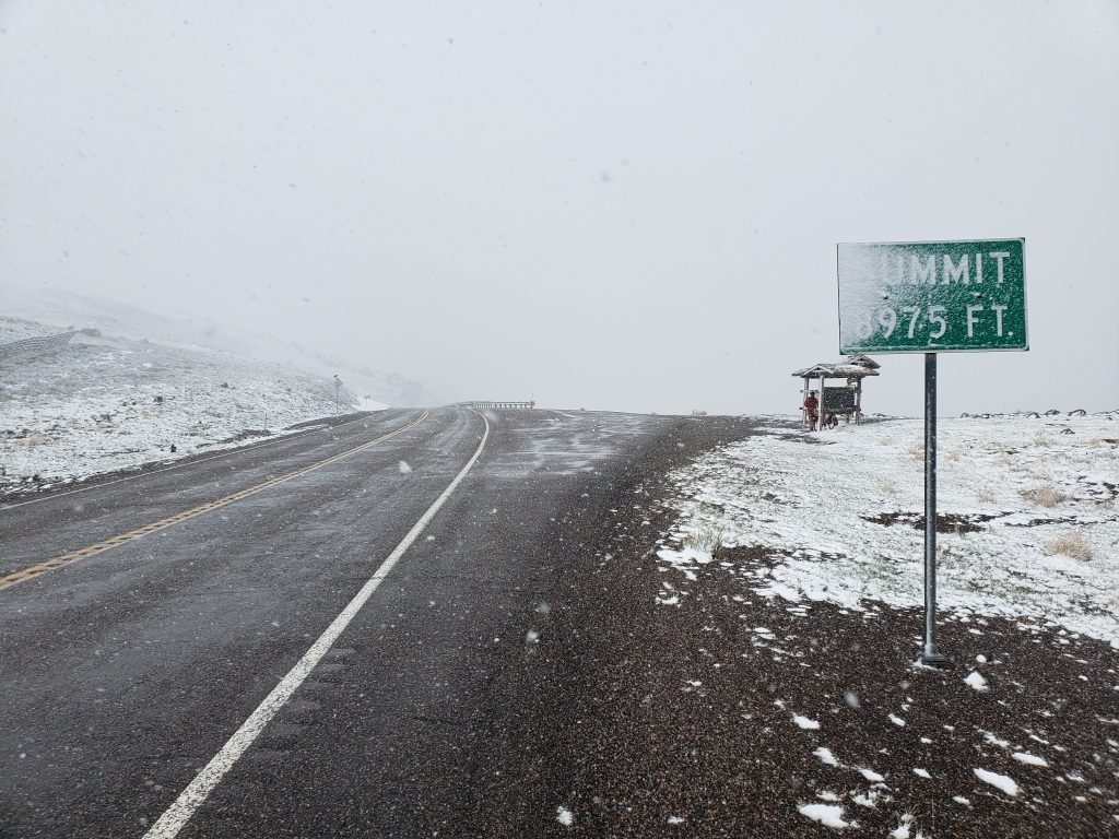
Once again the scenery changed as dense pine forests enveloped the road, only to be replaced with large swaths of aspen, just beginning to show the slightest of green, a sign of the approaching summer. The road wound higher and higher and we finally reached the unnamed pass at 9600 feet and stopped for photos. Depending on which route we chose from now on, this might be the highest elevation we reach on this tour.

The road on the north side of the pass is not graded very smoothly and steep descents of up to 10% grade are interrupted by equally steep but brief ascents. On my tour 9 years ago I was only able to go faster than forty miles per hour once – on an otherwise unremarkable hill in Ohio. Thanks to headwinds, not even on the multitude of 9,000, 10,000, or 11,000 foot passes was I able to achieve forty miles per hour. But on this descent today I got above forty miles per hour at least half a dozen distinct times, topping out at 44.7.

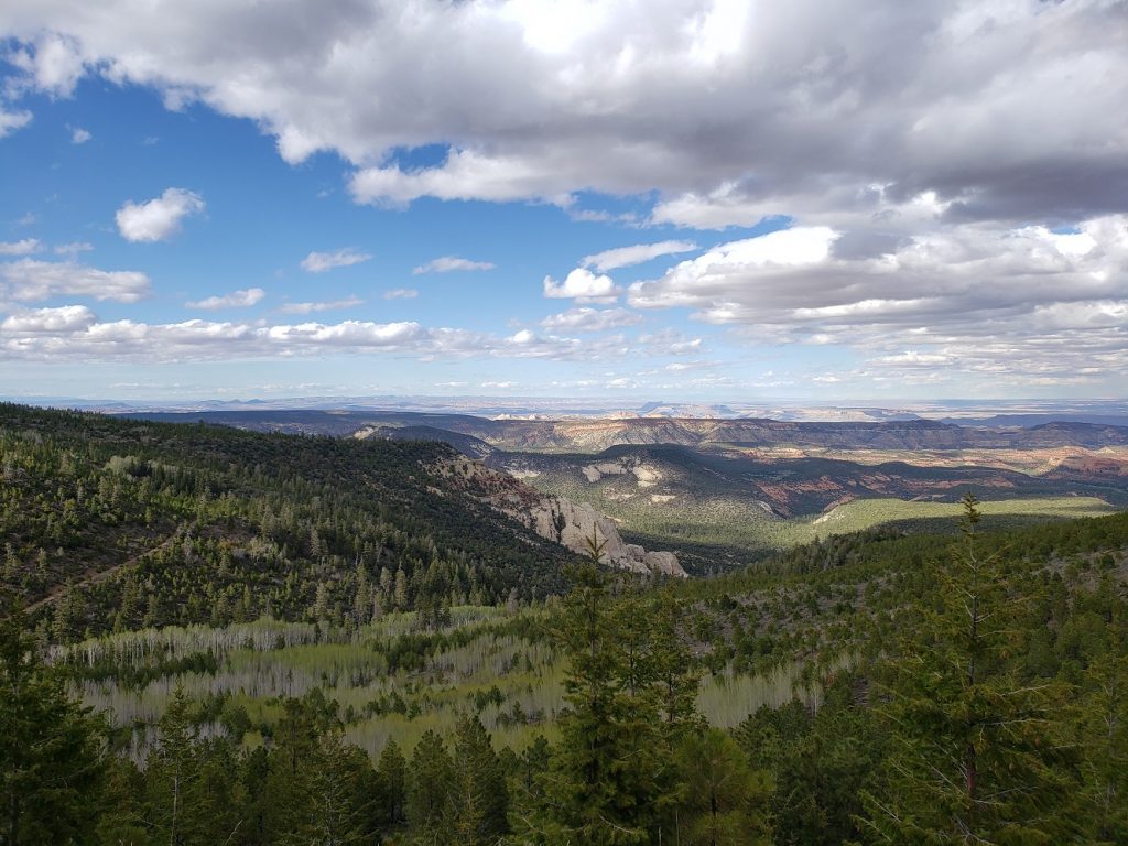
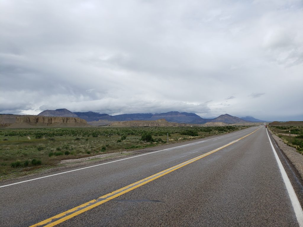
The scenery to the north of the pass was equally impressive as that to the south, with red cliffs and mountains as far as the eye can see. After a long descent we arrived at the town of Torrey, – at the edge of Capitol Reef National Park – and found a place to stay.

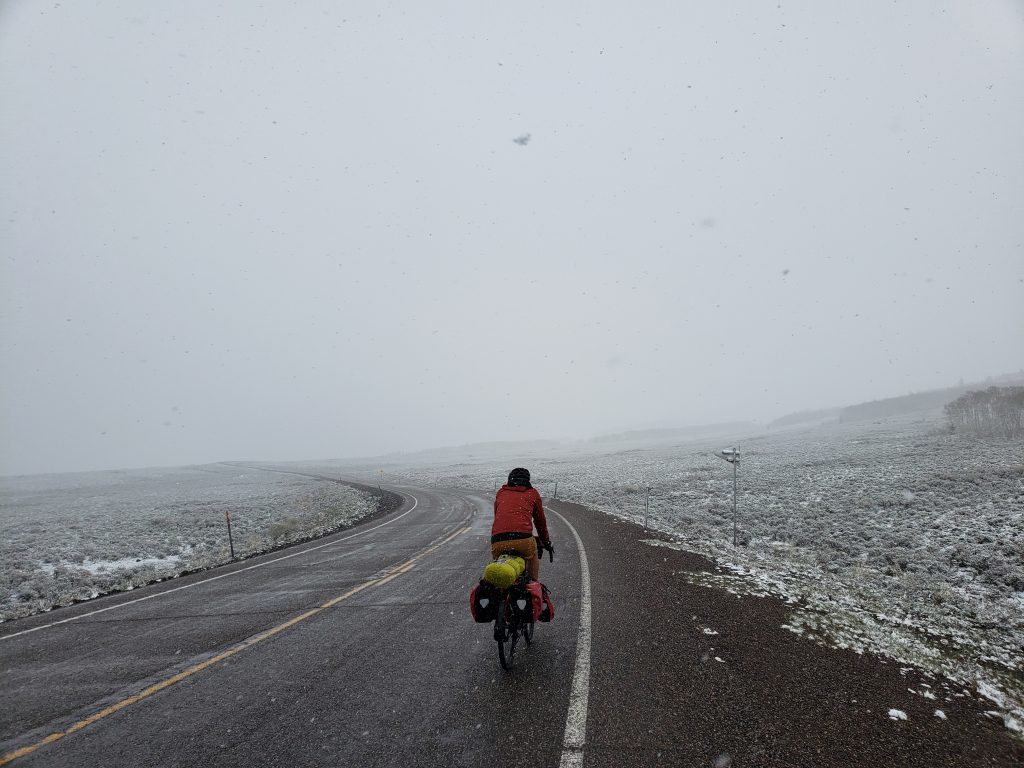
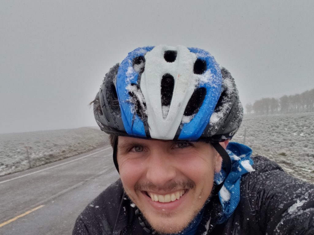
Notes from Donald: “I’m tired of climbing. But the Calf Creek Canyon was really cool to pass through. I’m glad it didn’t snow today.”

Today’s mileage: 70 miles, 6872 feet of elevation gain

Total: 967 miles